Notes from the Committee Meeting on 5-20-08
By Phyllis Hasbrouck
Present at the table: Alder Steve Arnold (Chair), Alder Andy Potts, Alder Jay Allen, Alder Bill Horns, Samuel Cooke (RCC Chair), Tom Hovel (Senior Planner), Randy Christianson (with Sveum Enterprises). Present around the edge of the room: about 18 consultants, neighbors, and observers.
I won't report everything, just some highlights and lowlights.
Frog and Toad Need More Space!
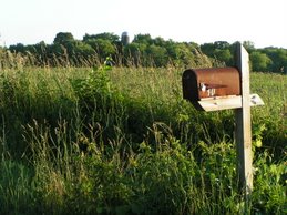
At the last meeting, developer Phil Sveum said that a 75 ft. buffer would be enough for the restored wetland, not the 300 ft. buffer that the city had proposed. He was answered today by Professor Joy Zedler (UW Madison) who spoke about the need for very wide buffer zones around streams and wetlands to protect amphibians and reptiles. She cited the work of Dr. Ray Semlitsch, who found (using transmitters) that amphibians travel 125.3 meters (370 ft.), from wetlands to terrestrial habitat.
Dr. Semlitsch suggested an aquatic buffer zone of up to 30 - 60 meters, then the core habitat at a width of 142 - 289 meters, and then a terrestrial buffer of 50 meters, for a total of somewhere between 222 meters and 399 meters (728 feet and 1309 feet).
Dr. Zedler also spoke of how buffers help protect wetlands from the negative effects of stormwater runoff, which are: excess water, excess nutrients, and excess sediment. At the Arboretum, Dr. Zedler's team has shown how tubs planted with 14 native species are filled with nothing but Reed Canary Grass (a highly invasive, non-native species) in just one season when exposed to these effects.
She displayed a map that showed how huge portions of the E-way and other Dane County wetlands were completely overrun with Reed Canary Grass and cattails, another invasive species.
Which Will Prevail: Parks or Subdivisions?
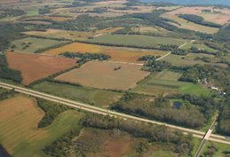
Then there was the whole curious matter of the clash between the Sveum plan and the Parks and Open Space Plan. Randy Christianson said that Sveum Enterprises had adjusted their plan to accommodate environmental corridors, and Anne Marie Kirsch (of Montgomery Associates, hired by Sveum Enterprises to do their water studies) showed a composite slide which I found confusing because, although I believe it was intended to reconcile the parks plan with the street plan, it didn't seem to show all of the proposed Parks Dept. areas on it. Jim Schreiber, a consultant for Sveum Enterprises, also showed a slide of the changes they had made to accommodate wildlife: I found them underwhelming.
Ed Bartell, City Forester, from the Fitchburg Parks & Forestry Department, showed a revised map of what they would like to have as parks and open space in the NE Neighborhood (NEN), and frankly, it doesn't leave a lot of room for houses! Bartell wants to have an assessment done on the tree line (~100 ft. wide) that goes north from Goodland Park Rd to the forest at the top of the hill. He said it may be a corridor for wildlife and may contain remnants of oak savanna.
They also want to preserve a diagonal band of recharge area in the northwestern part of Sveum's land, and to investigate if there is an Indian trail west of the tree line, as historical documents indicate.
Parks revised their map because at the last NEN Land Use Committee meeting on April 29, Jeff Kraemer of Natural Resources Consulting (hired by either Sveum Enterprises or Montgomery Associates) said that the soil tests that he had conducted showed that much of what the USDA maps listed as hydric soils (wetland soils) were not hydric at all. So Parks gave up trying to save them.
But a funny thing came to light at this meeting: Resource Conservation Committee Chair, Samuel Cooke, had shown the data to a soil scientist, and the scientist maintained that Kraemer was not accurately portraying the data. For example, Kraemer cited pit #14, located in "Lake Larsen" (the degraded wetland that held about 15 acres of open water this spring) as a site which had hydric soil. About a quarter mile west was pit #17, which he said was not hydric.
Cooke asked how Kraemer could be sure where the boundary was between hydric and non-hydric soils, using only two reference points. Kraemer replied that he had not mapped the hydric soils, but then expressed his opinion that they only existed in one area and not another, something that was not proven by his data.
I've noticed that it is very hard to pin consultants down. They are very smooth talkers and rarely (if ever) say, "I don't know," or "I see your point," or "I guess you're right about that." Instead, I hear things like "We are addressing those issues," or "It's very early to have that level of detail, we'll address that later," or "We are seeking to achieve a balance." So, Samuel Cooke deserves a lot of credit for following up and restating that the data did not reflect what Kraemer was saying.
Can Amphibians Read?
Jeff Kraemer also explained that the largest wetland buffer demanded by law in Wisconsin is 300 ft., for the Butler Gartersnake. But he said that it doesn't really have to be 300 ft. all around: it can be less in some places, as long as the total acreage in the buffer is equal to what it would have been had it been evenly laid out.
So, by extension, he felt it was all right if the western buffer of the "Lake Larsen" restored wetland were only 75 ft., because there would be ample open space to the north and the south. I wonder if they put up little signs in frog and toad language, reading "Go North or South and you'll find all the habitat you want. Don't try to cross this bike path 'cause you'll get crushed." And I wonder how well those signs work.
Eau Claire Shale and Infiltration
The question came up of whether or not the Eau Claire Shale Formation (an aquitard layer separating the upper and lower aquifers) exists under the Northeast Neighborhood. This was the subject of Dr. Cal DeWitt's presentation to the Common Council on Jan. 15, 2008. No one expressed any criticisms of Dr. DeWitt's logic or data, yet Rob Montgomery expressed his own belief that the shale does in fact exist here, and no one countered him.
Anne Marie Kirsch's explanation of the infiltration system, for the proposed Sveum development, didn't convince me of its short or long term effectiveness. She explained that the outlot raingardens (not necessarily on each block, as I thought I had heard before, but totaling five acres) would be maintained by the Neighborhood Association, and might have to be rehabbed in 10 years. If the raingardens stop working, and the Neighborhood Association stops functioning, will anyone care enough to rehab them? And how will that affect the wetlands, the groundwater, and Lake Waubesa?
She also said that the whole infiltration system wouldn't fully work until the upstream is stabilized, i.e. "some of the houses are built." (Why not all of the houses?) She explained that sediment running off a construction site could clog the system. This shocked me, because I know that the county has a stormwater ordinance that controls sediment runoff from construction sites very strictly. It's not supposed to happen.
Anyway, Kirsch conceded that the downhill retention ponds "may be a bit taxed at first." If the system doesn't work until the whole project is done, how much damage will have been done by the time the work is finished? Will there have been enough sediment, water and nutrients for Reed Canary Grass to completely take over the newly restored wetland.
If you care about how development decisions are made, you need to get involved. Please contact all of the Alders on the NEN Committee (Arnold, Allen, Potts and Horns) and tell them that you want decisions made for the good of the environment and the taxpayers. Developers perform a necessary function, but their monetary interests should not come before those of the city, the taxpayers, or the environment. If citizens don't call the alders, the only voices they hear are developers and their consultants!
Contact info for Alders can be found at http://www.city.fitchburg.wi.us/common_council/index.php
Saturday, May 24, 2008
NE Neighborhood Land Use Committee
Subscribe to:
Posts (Atom)