Department of Botany
University of Wisconsin-Madison
June 5, 2014
To: CARPC Staff and Commissioners, and Kamran Mesbah, PE, Director of Environmental Resources Planning, Capital Area Regional Planning Commission, City County Building, Room 362, 210 Martin Luther King Jr. Blvd., Madison WI 53703 allcommissioners@CapitalAreaRPC.org, KamranM@capitalarearpc.org
From: Joy B. Zedler, Ph.D., Professor of Botany and Aldo Leopold Chair of Restoration Ecology
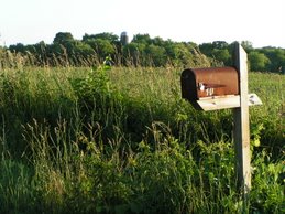
Re: Northeast Neighborhood (NEN)
I am a wetland scientist; I reside in the Town of Dunn at the headwaters of Murphy Creek. I have personal experience with runoff from Fitchburg, because a farm across the road from me despoils my native sedge meadow with sediment, nutrients, and pesticides. The runoff is converting native vegetation to Wisconsin’s worst wetland weed (reed canary grass, Phalaris arundinacea). A graduate student of mine recently showed that the portion of my sedge meadow that is dominated by reed canary grass has only half as many plant species as the area in front of the invasion, and many of the associates of reed canary grass are weeds. Another student documented increased nitrogen content of plant leaves as we sampled plants away from and close to the culvert that imports Fitchburg runoff from the corn/soybean field. The source of the problem is nutrient- rich runoff and the outcome is continued degradation and loss of substantial value (“natural capital”) due to runoff from a Fitchburg farm.
Here are my science-based concerns about urban development west of Larsen Road:
Agricultural runoff is damaging; urban runoff can be much worse. As rural agricultural lands convert to urban land use, the downstream wetlands lose native species and become dominated by invasive weeds, particularly
reed canary grass and hybrid cattails (Boers, Veltman and Zedler 2007, Frieswyk & Zedler 2007: “Our results show that increased urbanization in the watersheds of the Green Bay coastal wetlands (Fig. 3) coincided with the loss of wet meadow habitat (Fig. 7).”
The components of urban runoff that cause the conversion of wetland vegetation to invasive weeds are excess water, excess nutrients in the runoff, and excess nutrient-rich sediment, based on patterns in the field and controlled experiments in mesocosms (Kercher and Zedler 2004, Kercher, Carpenter and Zedler 2044, Kercher, Herr-Turoff and Zedler 2007: “We discovered a three-step invasion and degradation process: (1) initially, resident native species declined with prolonged flooding and sediment additions, and (2) prolonged flooding, sedimentation, and nutrients accelerated Phalaris aboveground growth; biomass rose to 430 times that of the control within just two growing seasons. The dramatic expansion of Phalaris in the second year resulted in the formation of monospecific stands in over one-third of the treatments, as (3) native species continued their decline in year 2. Disturbances acted alone and in combination to make the resident wetland community more invasible and Phalaris more aggressive, leading to monospecific stands.”).

Wetlands that hold water (i.e., prolonged hydroperiods) can support highly productive cattails at the expense of providing other ecosystem services, such as nutrient removal, soil stabilization, flood peak reduction, stormwater retention, and plant diversity support. In constructed wetlands, where we measured these six ecosystem services, we found the lowest levels in the wetland that became a wet pond (Doherty, Miller, Loheide, Prellwitz, Thompson, and Zedler In press): “Hence....ponding supported such high levels of NPP that other services appeared to be limited (suggesting tradeoffs).”
Settling ponds can remove some total suspended solids and some phosphorus, but dissolved phosphorus flows through the system, as does nitrogen (in both particulate and dissolved forms). Furthermore, nitrogen, which is poorly removed by wet ponds, is a major stimulus to species invasions in downstream wetlands (Herr-Turoff and Zedler 2005: “Increased N alone facilitates its suppression of native wetland vegetation (Green and Galatowitsch, 2002). Thus, Phalaris is presumed to have high N uptake and to increase retention of N within a wetland.”)
I often drive to/from work on Larsen Road and view the degraded wetland to the west. When it rains, I watch it collect enough water to become a pond, and when it rains heavily, it becomes a lake that spills over into the ditch along Larsen Road. The runoff is likely polluted with sediment, nutrients and pesticides. I have observed Swan Creek and Murphy Creek via canoe along the Lake Waubesa Wetlands (areas set aside by The Nature Conservancy and WDNR as a State Natural Area and recognized by Wisconsin Wetlands Association as a “Wetland Gem”). Wisconsin’s worst invasive weeds (reed canary grass and hybrid cattails) are poised to expand, as even more runoff and more nutrients flow downstream. And in Lake Waubesa, dense bluegreen algal blooms already occur in summer. More nutrient-rich runoff will further degrade the ecosystem services of both the lake and its adjacent wetlands.
These changes are inevitable if the NEN is allowed to develop without adequate buffers (at least 300’) around the maximum water level of the degraded wetland. A vegetated buffer could help absorb water, nutrients, and other pollutants. All one needs to do to see the effects of urbanization on our local wetlands is to compare vegetation along Swan Creek downstream from the Swan Creek development, or, at a much larger scale, the Nine Springs E-Way, which is dominated by the two worst wetland weeds in the state—reed canary grass and hybrid cattails. Waubesa wetlands need to be conserved and protected before it is too late. Upstream landowners who fail to protect downstream wetlands should be held responsible.
Why is it essential that our wetlands be protected from excess runoff of low quality water? In a updated analysis of the value of the world’s biomes, Costanza and colleagues (2014) provide new data that show the following (in 2007 US dollars): Four broad groups of wetlands provide $125,521 per hectare per year in ecosystem services, all of which lead to human well-being. That amount is 25 times the average for all other biomes. And comparing just the estimated value for ecosystem services derived from inland wetlands ($25,681/ha/yr) with that for cropland ($5,441/ha/yr) the ratio is 4.6. These services benefit all in perpetuity, so long as wetlands are conserved and protected from degradation.
Clearly, our inland wetlands are extremely valuable and deserve protection. Since Costanza published his first estimates of ecosystem service values in 1997, wetlands have become relatively more important providers of global ecosystem services, because other lands have undergone conversions to alternative uses, such as urbanization. Those changes in land use have reduced overall values of global ecosystem services some $4.3 - $20.2 trillion/yr from 1997 to 2011 (ibid.).

Some questions CARPC staff should look into:
• Why should wetlands in the Town of Dunn be degraded by inadequate protection measures in
Fitchburg?
• Why shouldn’t farmers be required to leave a buffer where their runoff flows downstream?
• Why shouldn’t urban developers be required to provide adequate buffers and treatment wetlands (not
just pits to collect phosphorus)?
• How will the impacts of any new development be assessed through actual monitoring of water,
nutrient, and sediment discharges?
• Why not establish a fine for improper protection of downstream wetlands? Fitchburg could require
developers to establish a bond so that downstream residents could obtain funds to provide weed abatement and other mitigating measures, such as nitrogen traps at the point of entry.
• Will contractors use the latest science-based information to design their runoff-control structures, instead of “best” management practices that are proving to be ineffective? I refer to topsoil addition to vegetated wetlands, reliance on “thick” vegetation to stabilize soil, and use of productive vegetation to indicate the presence of other ecosystem services. In our recent writings (Doherty et al. In press and Leaflets 27-28), we show how assumptions and predictions of models based on abiotic factors do not always hold up to actual measures of vegetated wetlands.
The Town of Dunn aims to protect wetlands that provide ecosystem services that benefit human well-being. If we apply the average value for inland wetlands from Costanza et al. (2014) to ~1,000 acres (404.7 ha) of set- aside lands, we provide an estimated $10,393,100 in ecosystem services per year. Even if that estimate is an order of magnitude too high, we still provide a million dollars in services annually, to the benefit of all in perpetuity (given wetland protection). Why should those values be diminished by inadequate buffering of upstream development to benefit a few people in the short term?
References cited:
Boers, A., R. Veltman, and J. B. Zedler. 2007. Typha x glauca dominance and extended hydroperiod constrain restoration of wetland diversity. Ecological Engineering 29:232-244.
Costanza, R., R. de Groot, P. Sutton, S. van der Ploeg, S. J. Anderson, I. Kubiszewski, S. Farber, and R. K. Turner. 2014. Changes in the global value of ecosystem services. Global Environmental Change 26:152–158.
Doherty, J. M., J. F. Miller, S. Prellwitz, A. M. Thompson, S. Loheide, and J. B. Zedler. In press. Bundles and tradeoffs among six wetland services were associated with hydrologic regime. Ecosystems.
Frieswyk, C. B., and J. B. Zedler. 2007. Vegetation change in Great Lakes coastal wetlands: Deviation from the historical cycle. Journal of Great Lakes Research 33:366-380.
Green E K and Galatowitsch S M 2002 Effects of Phalaris arundinacea and nitrate-N addition on the establishment of wetland plant communities. J. Appl. Ecol. 39, 134–144.
Herr-Turoff, A., and J. B. Zedler. 2005. Does wet prairie vegetation retain more nitrogen with or without Phalaris invasion. Plant and Soil 277:19-34.
Kercher, S. M., A. Herr-Turoff, and J B. Zedler. 2007. Understanding invasion as a process: The case of Phalaris arundinacea in wet prairies. Biological Invasions 9:657-665.
Kercher, S. M., and J. B. Zedler. 2004. Multiple disturbances accelerate invasion of reed canary grass (Phalaris arundinacea L.) in a mesocosm study. Oecologia 138:455-464.
Kercher, S. M., Q. Carpenter, and J. B. Zedler. 2004. Interrelationships of hydrologic disturbances, reed canary grass (Phalaris arundinacea L.), and native plants in Wisconsin wet meadows. Natural Areas Journal 24:316-325.
Leaflet #10. Why are wetlands so valuable? Online at uwarboretum.org/research - publications menu.
Leaflet #27. How ponded runoff and invasive cattails reduced wetland ecosystem services in three experimental wetlands. Online at uwarboretum.org/research - publications menu.
Leaflet #28. How ponded cattail marshes can expert phosphorus: A conceptual model. Online at uwarboretum.org/research - publications menu.
Tuesday, June 10, 2014
Wetland Scientist Dr. Joy Zedler Re: Proposed NEN Development
Sunday, March 17, 2013
What happened at the Fitchburg Common Council meeting on Feb. 26, and what it means
The Common Council approved the resolution to create an application for an Urban Service Area Amendment for the Northeast Neighborhood, but our fight isn't over yet! Click here to read more.
Sunday, March 10, 2013
Phyllis Hasbrouck: Fitchburg doesn't need more undeveloped land
[The original letter to the editor. An edited version appeared in the Wisconsin State Journal on 2/25/2013.]
Dear Editor,
Fitchburg Mayor Shawn Pfaff's desire to bring the Northeast Neighborhood into Fitchburg's Urban Service Area (USA) doesn't make sense from a taxpayer's point of view. His Plan Commission voted on Feb. 19 to instruct staff to create an application to the Capital Area Regional Planning Commission (CARPC).
But Fitchburg already has around 1175 acres of vacant land in its USA waiting to be developed, and its taxpayers are already on the hook to maintain and repair all of that infrastructure as soon as it is installed. The city leaders are already gambling that this huge area will fill up and provide the increased taxes needed to maintain and service it. Is this a good time to add another neighborhood's worth of infrastructure to sweep, plow, inspect and repair?
With 15 years' worth of land just waiting for builders and buyers, why extend urban services even farther from the city center? It doesn't take 15 years to jump through the CARPC hoops: more like 6 to 18 months. There is plenty of time to apply when Uptown and the North McGaw area fill up.
Ask the taxpayers of Oregon, Sun Prairie and Stoughton how they like paying to plow streets with just a few houses on them. Developers are risk-takers: when they are skilled or lucky, they get a big payoff. But the taxpayers shouldn't be forced to bet their hard-earned dollars on such a risky scheme.
On Feb. 26 the Fitchburg Common Council will meet at 7:30 p.m. and decide whether to plow ahead or wait. The taxpayers are invited to contact Mayor Pfaff at shawn.pfaff@city.fitchburg.wi.us and let him know what they want.
Yours,
Phyllis Hasbrouck
Chair, West Waubesa Preservation Coalition
Saturday, February 23, 2013
The Missing Aquitard: A short explanation of why you shouldn't drill deep wells near the Yahara chain of lakes by UW Madison Professor Cal DeWitt
Here is an illustration from Wisconsin Geological Survey's Ken Bradbury that shows that he knows the situation with the Eau Claire formation:

You can access this from:
http://www.nelson.wisc.edu/partnerships/programs/docs/bradbury_slideshow.pdf
A few things to observe here:
1. A the base of the diagram is "Recambrian crystalline rock" -- note that it steadily rises from the west to the east; this rise in Precambrian bedrock is part of the Wisconsin Arch. The "Mount Simon aquifer" was formed largely by sand deposition by an ancient sea over this arch.
The recent work of Wasinee Aswasereelert adds vital information to all of this, and has been published not only as her Master's dissertation in Geology at the University of Wisconsin-Madison, but also published as a refereed paper at: http://wisconsingeologicalsurvey.org/pdfs/geoscipdf/1_GS19.pdf
Thursday, February 21, 2013
Jay Allen: Say no to leapfrog development in Fitchburg
(Jay Allen, former mayor of Fitchburg and current mayoral candidate)
Many people believe that new development is always good for a community. Some types are good. They add to the tax base, create efficiencies in services, and, in some cases, can actually improve the pre-development environmental conditions.
Other developments may create new tax base, but also create huge drains on municipal services, cause significant environmental damage, and cost taxpayers far more than they provide in tax revenue.
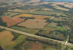
The City of Fitchburg is currently considering a development in the second category. Known as the Northeast Neighborhood, the area is bounded by Highway 14 on the west, Larsen Road on the east, East Clayton Road on the north, and Goodland Park Road and Haight Farm Road on the south. This area is not contiguous to any other development.
Fitchburg has roughly 1200 undeveloped acres within the Central Urban Service Area (CUSA). Those areas have available water and sewer. Almost all are within the a 4-minute response time for the fire department. They are contiguous to current development, so it is efficient to provide other municipal services, like police, trash collection, street maintenance, snow plowing, etc.
The Northeast Neighborhood is not within the CUSA. Fitchburg is considering submitting an application to the Capitol Area Regional Plan Commission (CARPC) to add it. This application should not be submitted, and, if submitted, it should be rejected. Some reasons are as follows:
1) The area is almost ¾ of a mile from the current edge of development. Municipal services will have to travel 1.5 miles round trip across vacant land, at significant cost.
2) The area currently has no water or sewer service. Fitchburg’s Water Utility will have to borrow in excess of $2 million to build those utilities. The area within the CUSA can currently be served with little additional investment. Existing areas should be built before burdening the ratepayers with the cost of new infrastructure.
3) The Northeast Neighborhood is 7 to 12 minutes away from Fire Station #1. This is unacceptable, and people will be endangered. The current mayor has suggested that the City of Madison could potentially cover that area. It seems unlikely that Madison taxpayers would subsidize this service. Current staffing at Madison Fire Station #6 is barely adequate, and an additional crew and an additional engine would be very costly.
4) Fitchburg’s last Urban Service Area amendment was approved in 2010. CARPC was promised that it would be at least 5 years before another request, and that was predicated on significant development occurring. Fewer than 6 buildings are under construction in the 1200 acres available. Reason would expect hundreds of buildings before requesting another amendment.
5) Development of the Northeast Neighborhood poses a significant risk to Lake Waubesa, which already has a eutrification problem. No studies have been done to examine what the effect will be on Lake Waubesa.
6) There is no reason to do this with so much land currently available and a sluggish market.
The major landowner involved is a political supporter of the current mayor. Politics should not play a factor in what should be objective planning decisions. Sacrificing environmental protection and taxpayer money should not happen to reward a political supporter. No reasonable person would support this amendment. I hope that in this case, reason will prevail.
Jay Allen
Former Mayor
City of Fitchburg
Rich Eggleston: Fitchburg development plans overly ambitious
(From a Letter to the Cap Times)
Dear Editor: The guy in the red vest got it wrong. It’s Fitchburg that is truly 35 square miles surrounded by reality.
Our little city is entertaining
grandiose plans to develop not one, not two, but four new
“neighborhoods” that will house thousands of new residents with whom we,
the existing residents, will be expected to share our schools, our
roads, and our limited crime and fire-fighting resources.
These starry-eyed development blueprints include:
•
The North McGaw neighborhood, a 398-acre tract. The entire McGaw
neighborhood, 720 acres, is supposed to provide 1,900 new homes and 2.4
million square feet of commercial space — enough for 13 “big box”
stores.
• “Uptown,” 450 acres in northeast Fitchburg, on which construction has already begun on 150 apartments in two buildings.
• The Northeast Neighborhood, which could add 800 to 1,400 new homes
•
The North Stoner Prairie neighborhood, 322 acres including some of the
best farmland in the world, which is envisioned as mostly industrial,
but with a residential component as well, east of Seminole Highway.
This
is all very nice. None of these developments is likely to include the
kind of ticky-tacky that development entailed in earlier days. But
Fitchburg may be biting off more than it can chew.
The
comprehensive plan that developers and city officials are using to
justify this growth was developed without in-depth consultation with our
neighbors on how to manage expected growth. Infrastructure costs money.
Despite the best-laid plans, growth inevitably damages the environment.
Fitchburg should not seek to bite off more than its rightful share of
Dane County’s expected population and economic growth. Doing so puts
existing home values, existing neighborhoods and the environment we all
cherish at risk. City officials must consider existing residents before
being seduced by the sirens of development.
Rich Eggleston
Fitchburg
Read more